



For digital format products, delivery takes place within 5 minutes of receiving payment, via email.
 Whatsapp
 Immediate Digital Delivery
Original License
Satisfaction or Money Back Within 30 Days
Easy Activation
Installation Guide Included
24/7 Support, Including on WhatsApp
Reusable in Case of Formatting
Multilingual
Updates Included Where Applicable
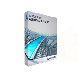
Autodesk Civil 3D is an advanced software solution for civil design, designed to support engineers, designers, and technicians working in the sectors of infrastructure, urban planning, and the environment. Based on the AutoCAD environment, Civil 3D integrates BIM (Building Information Modeling) functionality for planning, designing and documenting complex infrastructure projects such as roads, sewer networks, aqueducts, subdivisions, bridges, and railways.
Its strength lies in its ability to automate workflows, maintain data consistency, and reduce errors, improving design efficiency and collaboration among multidisciplinary teams.
Who it is suitable for:
Civil 3D is ideal for:
• Civil engineers and infrastructure designers • Engineering and urban planning consultancy firms • Surveying technicians and surveyors • Public bodies and municipalities responsible for managing road networks and territorial systems • Multidisciplinary BIM teams that integrate infrastructure into overall digital models
Main features:
• Land modeling and topographic surfaces: Civil 3D allows you to create three-dimensional surfaces from topographic surveys, GPS data, LAS/point cloud files, contour lines, and GIS data. • Advanced road design: Parametric tools for the design of roads, highways, and roundabouts, with detailed control of horizontal alignments, vertical alignments, and cross sections. • Drainage networks, sewers, and aqueducts: Integrated design of gravity or pressure pipe networks, with tools for modeling wells, pipes, excavations, and channels. • Subdivision and land division: Tools to create and manage lots, borders, property lines, with automatic calculations of areas, perimeters, and cadastral reports. • Railways, channels, and linear infrastructure: Design of railway routes, reclamation channels, embankments, and pipes, with precise management of sections and longitudinal geometry. • Automatic documentation and technical boards: Automatic generation of profiles, sections, labels, plans, and metric calculations. • Collaboration and integrated BIM flows: Civil 3D works in synergy with other Autodesk software (Revit, InfraWorks, Navisworks), supporting interoperable formats such as IFC, LandXML, DWG, DGN and data sharing via Autodesk Docs.
System requirements and compatibility:
Supported operating systems: • Windows 11 / Windows 10 (64 bit) Not natively available for macOS or Linux
Recommended hardware requirements: • Processor: Intel® Core i7/i9 or AMD Ryzen™ 7/9, multi-core • RAM: Minimum 16 GB (32 GB recommended for complex projects) • Graphics card: NVIDIA Quadro / RTX or AMD Radeon Pro, DirectX 11 compatible • Hard drive: SSD with at least 30 GB free • Screen resolution: 1920 x 1080 or higher (4K recommended)
Internet connection required for activation, updates, cloud collaboration, and access to services such as Autodesk Collaboration for Civil 3D.
What is included in Autodesk Civil 3D:
• 2D/3D CAD environment based on AutoCAD • Surface and terrain modeling • Design of roads, roundabouts, intersections, and corridors • Automatic calculation of longitudinal profiles and sections • Design of sewer, water, and drainage networks • Tools for subdivision and boundary management • Automatic generation of boards and metric calculations • Integration with Storm and Sanitary Analysis • Direct connection with InfraWorks, Navisworks, ReCap, Revit • Compatibility with GIS formats (SHP, XML, LAS)
Why choose Autodesk Civil 3D:
Autodesk Civil 3D is the complete solution for modern infrastructure design, able to transform territorial data into intelligent and updatable models. Thanks to dynamic design, real-time change management, and integration with the BIM flow, Civil 3D allows you to increase the quality of projects, reduce errors, and optimize design and construction times and costs.
Perfect for complex and multidisciplinary projects, it is the ideal tool to face the challenges of contemporary civil engineering.


Immediate Digital Delivery
Original License
Satisfaction or Money Back Within 30 Days
Easy Activation
Installation Guide Included
24/7 Support, Including on WhatsApp
Reusable in Case of Formatting
Multilingual
Updates Included Where Applicable